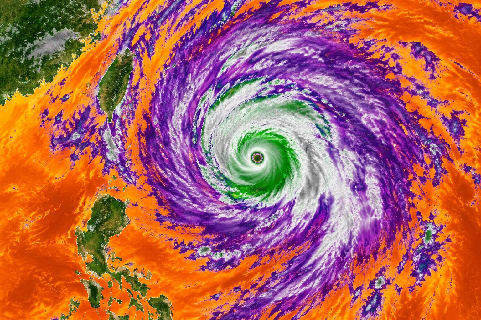
ESA image shows Super Typhoon Champi’s 50-kilometre-wide eye
A Copernicus Sentinel-3 image shows Super Typhoon Champi’s 50-kilometre-wide eye. ESA says the storm had maximum sustained winds of 296 kilometres per hour and caused flooding and damage in eastern Taiwan.
Review information is loading.
The European Space Agency has released a false-colour satellite image of Super Typhoon Champi, showing the storm’s eye about 50 kilometres across as it moved off Taiwan and the Philippines on 21 October. ESA describes Champi as the strongest tropical cyclone recorded so far in 2026, with maximum sustained winds of 296 kilometres per hour.
The image was captured by the Sea and Land Surface Temperature Radiometer aboard the Copernicus Sentinel-3 satellite. Its colours represent brightness temperatures inferred from thermal infrared measurements, rather than a natural-colour view of the storm.
ESA says the green, white and light-grey areas mark cold cloud tops at the storm’s centre, reaching temperatures as low as −70°C. Purple areas represent clouds between −30°C and −15°C, while orange shows warmer ocean and land surfaces averaging about 25°C.
The agency says Champi caused serious flooding and damage across eastern Taiwan, with waves reaching up to 10 metres near the storm’s centre. The image uses modified Copernicus Sentinel data from 2026, processed by ESA.
Sign in to give this article a thumbs up or down.
About this discussion and AI questions
Private test discussion. Comments are readers’ views and are not yet automatically fact-checked. Editing is available for 60 seconds after posting.
Sign in with a confirmed reader account and choose a username to read comments and participate.
Sorting applies to top-level comments; replies remain oldest first. New comments and likes can change the order. Refresh for the current ranking.
Loading comments…