News Made Clear · Loading…
Category
Regions
Continents
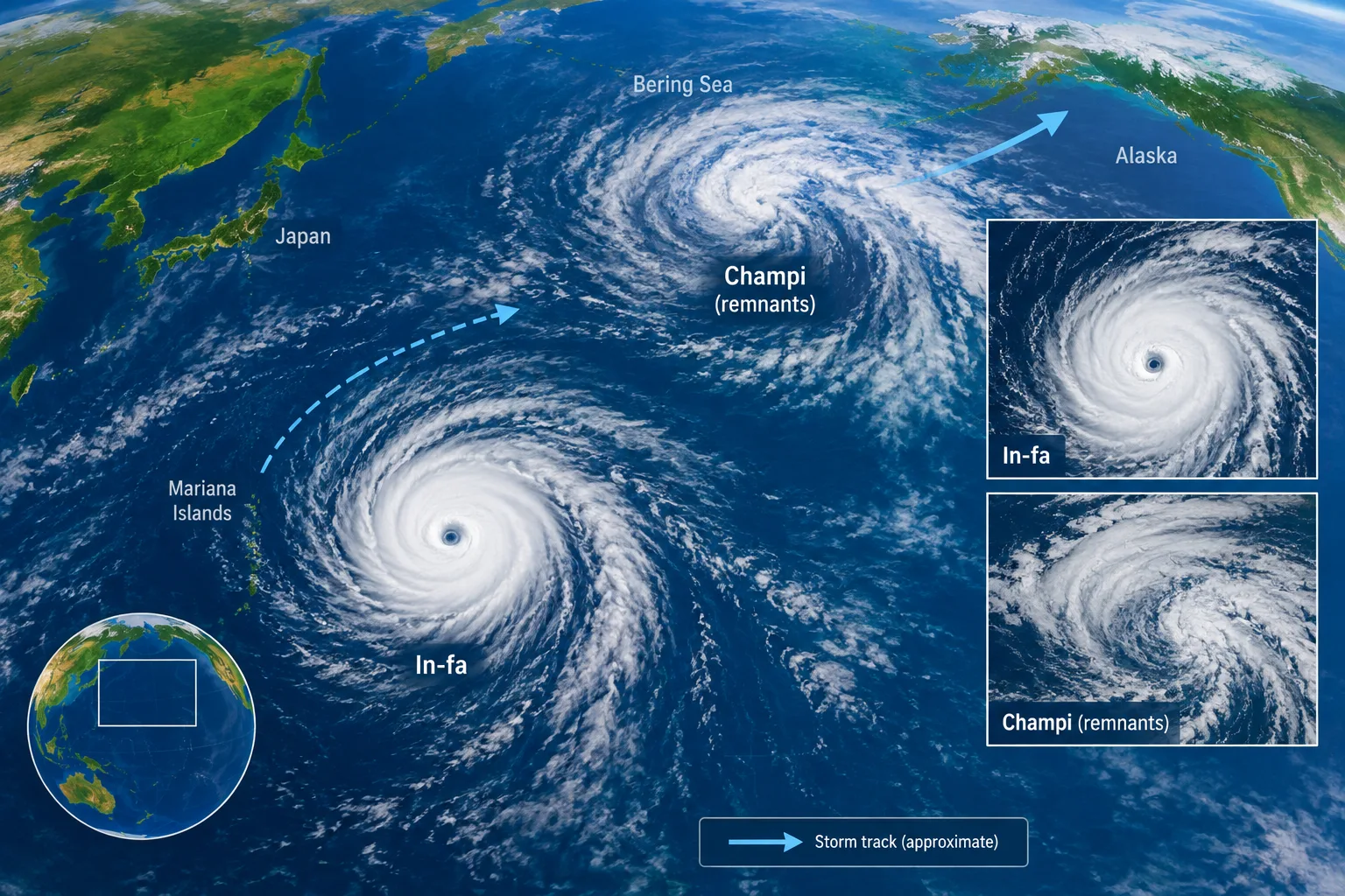
NASA images capture an active Pacific storm season
Loading statistics…
NASA satellite images show Super Typhoon In-fa near the Mariana Islands and Typhoon Champi’s remnants entering the Bering Sea, amid an active Pacific storm season.
Review information is loading.
Super Typhoon In-fa churned near the Mariana Islands as the remnants of Typhoon Champi crossed the Bering Sea towards Alaska, in a late-October snapshot of an unusually active Pacific storm season described by NASA.
NASA said tropical cyclone activity in the Northwest Pacific had been elevated since April 2026. By late October, the basin had seen 25 named storms. In-fa was the fifth typhoon to affect the Mariana Islands this year, according to the agency.
Satellite images captured on 29 and 30 October showed In-fa with a large, nearly circular eye. NASA said those features are associated with annular storms, a rare type that accounts for about 4 per cent of tropical cyclones in the western North Pacific. Their eyes average about 45 kilometres across, compared with about 25 kilometres for typical tropical cyclones.
Champi had meanwhile undergone an extratropical transition as it entered the Bering Sea storm track. NASA meteorologist Gary Partyka said this process expands a storm’s wind field, although the winds do not necessarily become stronger. He said Champi appeared to have become intertwined with and helped intensify a larger storm system, while noting that a mid-latitude storm could have formed in the area even without Champi’s remnants.
NASA said Alaska avoided damage on the scale caused by ex-typhoon Halong in 2025, although some areas experienced high winds and heavy rain and snowfall. Champi was the fourth former typhoon to enter Alaskan waters this year, according to University of Alaska Fairbanks meteorologist Rick Thoman. He noted that the autumns of 1997 and 2015, both strong El Niño years, each saw three.
Partyka described 2026 as a particularly active year for Pacific tropical cyclones and said the strong El Niño was a likely contributor. NASA says El Niño can encourage storms in the Northwest Pacific to curve northwards, bringing more towards Guam, the Northern Mariana Islands, Japan and the Korean Peninsula.
How do we know?
1 listed sources · explore evidence, limitations and provenance.
Sign in to give this article a thumbs up or down.
About this discussion and AI questions
Private test discussion. Comments are readers’ views and are not yet automatically fact-checked. Editing is available for 60 seconds after posting.
Sign in with a confirmed reader account and choose a username to read comments and participate.
Sorting applies to top-level comments; replies remain oldest first. New comments and likes can change the order. Refresh for the current ranking.
Loading comments…