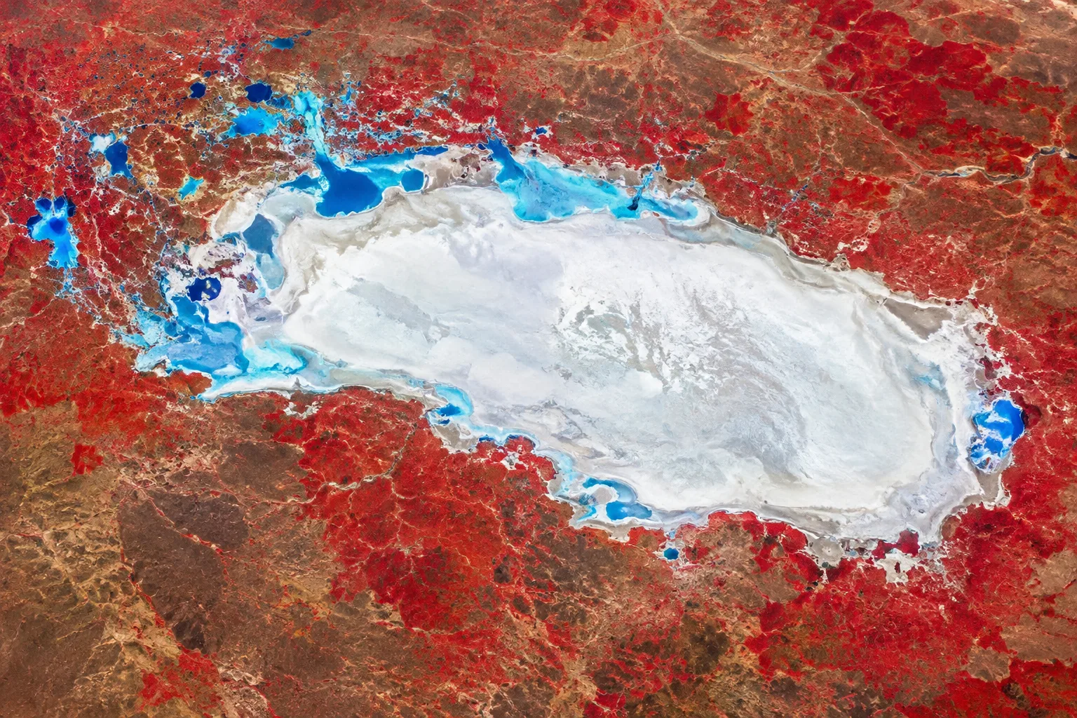
ESA satellite image shows Namibia’s Etosha Pan at start of dry season
An image taken by Copernicus Sentinel-2 in April and published in October shows Namibia’s Etosha Pan in false colour, with vegetation and water visible around the salt flat.
Review information is loading.
The European Space Agency published the image on 9 October 2026, but the satellite captured it six months earlier, on 5 April. It shows Etosha National Park in northern Namibia and its main salt flat, the Etosha Pan, which ESA says stretches roughly 130 kilometres from east to west and covers 4,760 square kilometres. [1]
This is a false-colour image, not a view of the landscape as the human eye would see it. The white expanse marks the salt pan, while red highlights vegetation. Shades of blue indicate water: ESA says lighter blue shows water containing cloudy sediment and darker blue shows clearer water. Sentinel-2’s imager detects light in 13 spectral bands, allowing it to highlight features such as vegetation. [1]
ESA says the image was taken at the beginning of the dry season, when water was still present in smaller salt pans north-west of Etosha Pan. That observation describes conditions in April, not when the image was published in October. [1]
Sign in to give this article a thumbs up or down.
About this discussion and AI questions
Private test discussion. Comments are readers’ views and are not yet automatically fact-checked. Editing is available for 60 seconds after posting.
Sign in with a confirmed reader account and choose a username to read comments and participate.
Sorting applies to top-level comments; replies remain oldest first. New comments and likes can change the order. Refresh for the current ranking.
Loading comments…